Difference between revisions of "Fayette County, Ohio"
m |
m |
||
| (8 intermediate revisions by the same user not shown) | |||
| Line 1: | Line 1: | ||
| − | {{Infobox U.S. | + | {{Infobox U.S. county| |
county = Fayette County| | county = Fayette County| | ||
state = Ohio | | state = Ohio | | ||
seal = Seal of Fayette County Ohio.svg | | seal = Seal of Fayette County Ohio.svg | | ||
| − | founded = March 1, 1810 | + | founded = March 1, 1810 | |
| − | seat wl = Washington Court House | | + | seat wl = Washington Court House | |
largest city = Washington Court House | | largest city = Washington Court House | | ||
| − | area_total_sq_mi = 407 | + | area_total_sq_mi = 407 | |
| − | area_land_sq_mi = 406 | + | area_land_sq_mi = 406 | |
| − | area_water_sq_mi = 0. | + | area_water_sq_mi = 0.7 | |
| − | area percentage = 0. | + | area percentage = 0.2% | |
| − | census yr = | + | census estimate yr = 2019 | |
| − | pop = | + | pop = 28525 | |
| − | density_sq_mi = 71 | + | density_sq_mi = 71 | |
time zone = Eastern | | time zone = Eastern | | ||
| − | web = www.fayette-co-oh.com/| | + | web = www.fayette-co-oh.com/ | |
named for = [[wikipedia:Marquis de Lafayette|Marquis de Lafayette]] | named for = [[wikipedia:Marquis de Lafayette|Marquis de Lafayette]] | ||
| ex image = Washington Courthouse Ohio.jpg | | ex image = Washington Courthouse Ohio.jpg | ||
| ex image size = 250 | | ex image size = 250 | ||
| ex image cap = [[wikipedia:Fayette County Courthouse (Ohio)|Fayette County Courthouse]] | | ex image cap = [[wikipedia:Fayette County Courthouse (Ohio)|Fayette County Courthouse]] | ||
| − | |||
| district2 = 15th | | district2 = 15th | ||
| − | } | + | }| footnotes = For infobox source see<ref>{{cite web |
| − | + | | title = Fayette County, Ohio | |
| − | == | + | | publisher = Wikipedia |
| − | = | + | | url = https://en.wikipedia.org/wiki/Fayette_County,_Ohio |
| − | + | | accessdate = 2021-01-11}}</ref> | |
| − | == | + | }}__TOC__ |
| + | == County Well Data == | ||
{| class="wikitable sortable" width="95%" | {| class="wikitable sortable" width="95%" | ||
!scope="col" | Well ID | !scope="col" | Well ID | ||
!scope="col" | Municipality | !scope="col" | Municipality | ||
!scope="col" | Operator Name | !scope="col" | Operator Name | ||
| − | !scope="col" | | + | !scope="col" style="white-space: nowrap"| Permit Date |
| − | !scope="col" | Spud Date | + | !scope="col" style="white-space: nowrap"| Spud Date |
| − | !scope="col" | | + | !scope="col" | Configuration |
| − | !scope="col" | | + | !scope="col" | License Status |
| − | + | |- | |
| − | + | | [[34-047-20001]] | |
| + | | [[Union_Township,_Fayette_County,_Ohio|Union Township]] | ||
| + | | [[HISTORIC OWNER]] | ||
| + | | | ||
| + | | 1957-05-12 | ||
| + | | Vertical | ||
| + | | Plugged and Abandoned | ||
| + | |- | ||
| + | | [[34-047-20002]] | ||
| + | | [[Concord_Township,_Fayette_County,_Ohio|Concord Township]] | ||
| + | | [[HISTORIC OWNER]] | ||
| + | | 1957-07-19 | ||
| + | | 1957-07-22 | ||
| + | | Vertical | ||
| + | | Final Restoration | ||
| + | |- | ||
| + | | [[34-047-20003]] | ||
| + | | [[Union_Township,_Fayette_County,_Ohio|Union Township]] | ||
| + | | [[HISTORIC OWNER]] | ||
| + | | 1958-07-11 | ||
| + | | 1958-07-11 | ||
| + | | Vertical | ||
| + | | Final Restoration | ||
| + | |- | ||
| + | | [[34-047-20004]] | ||
| + | | [[Jasper_Township,_Fayette_County,_Ohio|Jasper Township]] | ||
| + | | [[HISTORIC OWNER]] | ||
| + | | 1958-11-07 | ||
| + | | 1958-11-11 | ||
| + | | Vertical | ||
| + | | Final Restoration | ||
| + | |- | ||
| + | | [[34-047-20005]] | ||
| + | | [[Union_Township,_Fayette_County,_Ohio|Union Township]] | ||
| + | | [[HISTORIC OWNER]] | ||
| + | | 1958-11-28 | ||
| + | | 1958-12-01 | ||
| + | | Vertical | ||
| + | | Plugged and Abandoned | ||
| + | |- | ||
| + | | [[34-047-20006]] | ||
| + | | [[Perry_Township,_Fayette_County,_Ohio|Perry Township]] | ||
| + | | [[HISTORIC OWNER]] | ||
| + | | 1960-01-29 | ||
| + | | 1960-01-29 | ||
| + | | Vertical | ||
| + | | Plugged and Abandoned | ||
| + | |- | ||
| + | | [[34-047-20007]] | ||
| + | | [[Perry_Township,_Fayette_County,_Ohio|Perry Township]] | ||
| + | | [[HISTORIC OWNER]] | ||
| + | | 1964-06-26 | ||
| + | | 1964-08-13 | ||
| + | | Vertical | ||
| + | | Plugged and Abandoned | ||
| + | |- | ||
| + | | [[34-047-20008]] | ||
| + | | [[Marion_Township,_Fayette_County,_Ohio|Marion Township]] | ||
| + | | [[HISTORIC OWNER]] | ||
| + | | 1973-08-08 | ||
| + | | 1973-10-22 | ||
| + | | Vertical | ||
| + | | Final Restoration | ||
| + | |- | ||
| + | | [[34-047-20009]] | ||
| + | | [[Madison_Township,_Fayette_County,_Ohio|Madison Township]] | ||
| + | | [[OXFORD OIL]] | ||
| + | | 1979-04-25 | ||
| + | | 1979-07-11 | ||
| + | | Vertical | ||
| + | | Final Restoration | ||
| + | |- | ||
| + | | [[34-047-20010]] | ||
| + | | [[Wayne_Township,_Fayette_County,_Ohio|Wayne Township]] | ||
| + | | [[HISTORIC OWNER]] | ||
| + | | 1979-05-31 | ||
| + | | 1979-07-23 | ||
| + | | Vertical | ||
| + | | Plugged and Abandoned | ||
| + | |- | ||
| + | | [[34-047-20011]] | ||
| + | | [[Marion_Township,_Fayette_County,_Ohio|Marion Township]] | ||
| + | | [[CGAS EXPLORATION]] | ||
| + | | 1982-12-27 | ||
| + | | 1983-01-20 | ||
| + | | Vertical | ||
| + | | Final Restoration | ||
| + | |- | ||
| + | | [[34-047-20012]] | ||
| + | | [[Concord_Township,_Fayette_County,_Ohio|Concord Township]] | ||
| + | | [[CGAS EXPLORATION]] | ||
| + | | 1983-11-21 | ||
| + | | | ||
| + | | Vertical | ||
| + | | Not Drilled | ||
| + | |- | ||
| + | | [[34-047-20013]] | ||
| + | | [[Wayne_Township,_Fayette_County,_Ohio|Wayne Township]] | ||
| + | | [[ENERVEST OPERATING LLC]] | ||
| + | | 1983-11-21 | ||
| + | | | ||
| + | | Vertical | ||
| + | | Final Restoration | ||
| + | |- | ||
| + | | [[34-047-60002]] | ||
| + | | [[Paint_Township,_Fayette_County,_Ohio|Paint Township]] | ||
| + | | [[HISTORIC OWNER]] | ||
| + | | | ||
| + | | 1900-01-01 | ||
| + | | Vertical | ||
| + | | Final Restoration | ||
| + | |- | ||
| + | | [[34-047-60003]] | ||
| + | | [[Wayne_Township,_Fayette_County,_Ohio|Wayne Township]] | ||
| + | | [[HISTORIC OWNER]] | ||
| + | | | ||
| + | | | ||
| + | | Vertical | ||
| + | | Well Permitted | ||
| + | |- | ||
|} | |} | ||
| + | For data sources see<ref>{{cite web | ||
| + | | title = Risk Based Data Management System | ||
| + | |publisher = [[Ohio Department of Natural Resources]] | ||
| + | | date = 2020-11-16 | ||
| + | | url = http://wellwiki.org/wiki/Ohio_Oil_and_Gas_Data_Sources | ||
| + | | accessdate = 2020-11-16 }}</ref> | ||
| + | ==References== | ||
| + | <references/> | ||
__NOEDITSECTION__ | __NOEDITSECTION__ | ||
| − | |||
Latest revision as of 16:33, 11 January 2021
| Fayette County, Ohio | ||
|---|---|---|
| ||
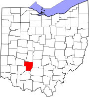
 Location in the state of Ohio | ||
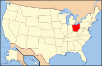
 Ohio's location in the U.S. | ||
| Founded | March 1, 1810 | |
| Named for | Marquis de Lafayette | |
| Seat | Washington Court House | |
| Largest city | Washington Court House | |
| Area | ||
| • Total | 407 sq mi (1,054 km2) | |
| • Land | 406 sq mi (1,052 km2) | |
| • Water | 0.7 sq mi (2 km2), 0.2% | |
| Population (Est.) | ||
| • (2019) | 28,525 | |
| • Density | 71/sq mi (27/km²) | |
| Congressional districts |
[[Ohio's 15th } congressional district|15th }]] | |
| Time zone | Eastern: UTC-5/-4 | |
| Website | www.fayette-co-oh.com | |
| Footnotes: For infobox source see[1] | ||
Contents
County Well Data
| Well ID | Municipality | Operator Name | Permit Date | Spud Date | Configuration | License Status |
|---|---|---|---|---|---|---|
| 34-047-20001 | Union Township | HISTORIC OWNER | 1957-05-12 | Vertical | Plugged and Abandoned | |
| 34-047-20002 | Concord Township | HISTORIC OWNER | 1957-07-19 | 1957-07-22 | Vertical | Final Restoration |
| 34-047-20003 | Union Township | HISTORIC OWNER | 1958-07-11 | 1958-07-11 | Vertical | Final Restoration |
| 34-047-20004 | Jasper Township | HISTORIC OWNER | 1958-11-07 | 1958-11-11 | Vertical | Final Restoration |
| 34-047-20005 | Union Township | HISTORIC OWNER | 1958-11-28 | 1958-12-01 | Vertical | Plugged and Abandoned |
| 34-047-20006 | Perry Township | HISTORIC OWNER | 1960-01-29 | 1960-01-29 | Vertical | Plugged and Abandoned |
| 34-047-20007 | Perry Township | HISTORIC OWNER | 1964-06-26 | 1964-08-13 | Vertical | Plugged and Abandoned |
| 34-047-20008 | Marion Township | HISTORIC OWNER | 1973-08-08 | 1973-10-22 | Vertical | Final Restoration |
| 34-047-20009 | Madison Township | OXFORD OIL | 1979-04-25 | 1979-07-11 | Vertical | Final Restoration |
| 34-047-20010 | Wayne Township | HISTORIC OWNER | 1979-05-31 | 1979-07-23 | Vertical | Plugged and Abandoned |
| 34-047-20011 | Marion Township | CGAS EXPLORATION | 1982-12-27 | 1983-01-20 | Vertical | Final Restoration |
| 34-047-20012 | Concord Township | CGAS EXPLORATION | 1983-11-21 | Vertical | Not Drilled | |
| 34-047-20013 | Wayne Township | ENERVEST OPERATING LLC | 1983-11-21 | Vertical | Final Restoration | |
| 34-047-60002 | Paint Township | HISTORIC OWNER | 1900-01-01 | Vertical | Final Restoration | |
| 34-047-60003 | Wayne Township | HISTORIC OWNER | Vertical | Well Permitted |
For data sources see[2]
References
- ↑ "Fayette County, Ohio". Wikipedia. Retrieved 2021-01-11.
- ↑ "Risk Based Data Management System". Ohio Department of Natural Resources. 2020-11-16. Retrieved 2020-11-16.

