X

Track changes made to this page

If you find this page useful and would like to be notified of changes made to this page, start by inputting your email below.


Privacy policy
Close this window

powered by ChangeDetection

Deaf Smith County, Texas

Deaf Smith County, Texas
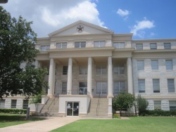
Deaf Smith County, TX, Courthouse IMG 4835.JPG
Deaf Smith County Courthouse in Hereford
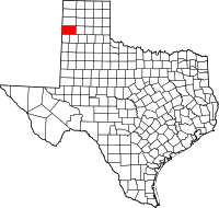
Map of Texas highlighting Deaf Smith County
Location in the state of Texas
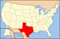
Map of the United States highlighting Texas
Texas's location in the U.S.
Founded 1890
Named for Deaf Smith
Seat Hereford
Largest city Hereford
Area
 • Total 1,498 sq mi (3,880 km2)
 • Land 1,497 sq mi (3,877 km2)
 • Water 1.5 sq mi (4 km2), 0.1%
Population
 • (2010) 19,372
 • Density 13/sq mi (5/km²)
Time zone Central: UTC-6/-5
Website www.co.deaf-smith.tx.us
Footnotes: For infobox source see[1]

County Well Data

Well ID Operator Name Well Type Lease
42-117-30096 Buttes Resources Company
42-117-30097 AMERICAN PETROFINA CO. OF TEX.
42-117-30099 AMERICAN PETROFINA CO. OF TEX.
42-117-30100 AMERICAN PETROFINA CO. OF TEX.
42-117-30101 GUARDIAN OIL COMPANY
42-117-30102 VOYAGER PETROLEUMS, INC.
42-117-30103 STONE & WEBSTER ENGINEERING CORP
42-117-30104 STONE & WEBSTER ENG. CORP.
42-117-30105 MULLIN OIL CO.
42-117-30106 EDWARDS & HOGAN
42-117-30107 STONE & WEBSTER ENGINEERING CORP
42-117-30108 STONE & WEBSTER ENGINEERING CORP
42-117-30109 STONE & WEBSTER ENGINEERING CORP
42-117-30110 HUDSON RESOURCES CORPORATION
42-117-30111 Pennzoil Company
42-117-30112 BAKER & TAYLOR DRILLING CO.
42-117-30113 ENERGAS COMPANY
42-117-30114 ENERGAS COMPANY

For data sources see[2]

References

  1. "Deaf Smith County, Texas". Wikipedia. Retrieved 2020-12-09. 
  2. "RRC Digital Map Data". Railrod Commission of Texas. 2020-10-15. Retrieved 2020-10-15.