Difference between revisions of "Donley County, Texas"
m |
m |
||
| (2 intermediate revisions by the same user not shown) | |||
| Line 1: | Line 1: | ||
| − | {{Infobox U.S. | + | {{Infobox U.S. county| |
county = Donley County| | county = Donley County| | ||
state = Texas | | state = Texas | | ||
seal = | | seal = | | ||
| − | founded = 1882| | + | founded = 1882 | |
| − | seat wl= Clarendon | | + | seat wl = Clarendon | |
| − | largest city wl = Clarendon| | + | largest city wl = Clarendon | |
| − | area_total_sq_mi =933 | | + | area_total_sq_mi = 933 | |
| − | area_land_sq_mi =927 | | + | area_land_sq_mi = 927 | |
| − | area_water_sq_mi =6 | | + | area_water_sq_mi = 6.2 | |
area percentage = 0.7% | | area percentage = 0.7% | | ||
| − | census yr = | + | census estimate yr = 2015 | |
| − | pop = | + | pop = 3499 | |
| − | + | density_sq_mi = 4.0 | | |
| − | ex image = Donley | + | ex image = File:Donley County courthouse May 2020.jpg | |
| − | ex image size = 250| | + | ex image size = 250 | |
| − | ex image cap = | + | ex image cap = 1890 [[wikipedia:Donley County Courthouse and Jail|Donley County Courthouse]] in Clarendon | |
| − | web = www.co.donley.tx.us| | + | web = www.co.donley.tx.us | |
| time zone = Central | | time zone = Central | ||
| − | | | + | | footnotes = For infobox source see<ref>{{cite web |
| − | + | | title = Donley County, Texas | |
| − | + | | publisher = Wikipedia | |
| − | + | | url = https://en.wikipedia.org/wiki/Donley_County,_Texas | |
| − | = | + | | accessdate = 2020-12-09}}</ref> |
| − | == | + | }}__TOC__ |
| + | == County Well Data == | ||
{| class="wikitable sortable" width="95%" | {| class="wikitable sortable" width="95%" | ||
!scope="col" | Well ID | !scope="col" | Well ID | ||
| − | |||
!scope="col" | Operator Name | !scope="col" | Operator Name | ||
| − | !scope="col" | | + | !scope="col" | Well Type |
| − | !scope="col" | | + | !scope="col" | Lease |
| − | + | |- | |
| − | + | | [[42-129-00022]] | |
| − | + | | [[QUESTA ENERGY CORPORATION]] | |
| − | + | | | |
| + | | | ||
| + | |- | ||
| + | | [[42-129-00027]] | ||
| + | | [[SCOUT ENERGY MANAGEMENT LLC]] | ||
| + | | Gas | ||
| + | | 023734 | ||
| + | |- | ||
| + | | [[42-129-30096]] | ||
| + | | [[MERIDIAN OIL CORPORATION]] | ||
| + | | | ||
| + | | | ||
| + | |- | ||
| + | | [[42-129-30097]] | ||
| + | | [[SUOCO OIL CORP.]] | ||
| + | | | ||
| + | | | ||
| + | |- | ||
| + | | [[42-129-30098]] | ||
| + | | [[SUOCO OIL CORP.]] | ||
| + | | | ||
| + | | | ||
| + | |- | ||
| + | | [[42-129-30099]] | ||
| + | | [[SUOCO OIL CORP.]] | ||
| + | | | ||
| + | | | ||
| + | |- | ||
| + | | [[42-129-30100]] | ||
| + | | [[SUOCO OIL CORP.]] | ||
| + | | | ||
| + | | | ||
| + | |- | ||
| + | | [[42-129-30101]] | ||
| + | | [[SUOCO OIL CORP.]] | ||
| + | | | ||
| + | | | ||
| + | |- | ||
| + | | [[42-129-30102]] | ||
| + | | [[SUOCO OIL CORP.]] | ||
| + | | | ||
| + | | | ||
| + | |- | ||
| + | | [[42-129-30103]] | ||
| + | | [[SUOCO OIL CORP.]] | ||
| + | | | ||
| + | | | ||
| + | |- | ||
| + | | [[42-129-30104]] | ||
| + | | [[SUOCO OIL CORP.]] | ||
| + | | | ||
| + | | | ||
| + | |- | ||
| + | | [[42-129-30105]] | ||
| + | | [[UNITED PETROSEARCH, INC.]] | ||
| + | | | ||
| + | | | ||
| + | |- | ||
| + | | [[42-129-30106]] | ||
| + | | [[STONE & WEBSTER ENGINEERING CORP]] | ||
| + | | | ||
| + | | | ||
| + | |- | ||
| + | | [[42-129-30107]] | ||
| + | | [[STONE & WEBSTER ENGINEERING CORP]] | ||
| + | | | ||
| + | | | ||
| + | |- | ||
| + | | [[42-129-30108]] | ||
| + | | [[WINN EXPLORATION/DULCE COMPANY]] | ||
| + | | | ||
| + | | | ||
| + | |- | ||
| + | | [[42-129-30109]] | ||
| + | | | ||
| + | | | ||
| + | | | ||
| + | |- | ||
| + | | [[42-129-30110]] | ||
| + | | [[PRIDE PIPELINE COMPANY]] | ||
| + | | | ||
| + | | | ||
| + | |- | ||
| + | | [[42-129-30111]] | ||
| + | | [[PRIDE PIPELINE COMPANY]] | ||
| + | | | ||
| + | | | ||
| + | |- | ||
| + | | [[42-129-30112]] | ||
| + | | [[SCOUT ENERGY MANAGEMENT LLC]] | ||
| + | | Gas | ||
| + | | 168601 | ||
| + | |- | ||
| + | | [[42-129-30113]] | ||
| + | | [[SCOUT ENERGY MANAGEMENT LLC]] | ||
| + | | Gas | ||
| + | | 169340 | ||
| + | |- | ||
| + | | [[42-129-30114]] | ||
| + | | [[GRUY PETROLEUM MANAGEMENT CO.]] | ||
| + | | | ||
| + | | | ||
| + | |- | ||
| + | | [[42-129-30115]] | ||
| + | | [[SCOUT ENERGY MANAGEMENT LLC]] | ||
| + | | Gas | ||
| + | | 167588 | ||
| + | |- | ||
| + | | [[42-129-30116]] | ||
| + | | [[SCOUT ENERGY MANAGEMENT LLC]] | ||
| + | | Gas | ||
| + | | 172394 | ||
| + | |- | ||
| + | | [[42-129-30117]] | ||
| + | | [[GRUY PETROLEUM MANAGEMENT CO.]] | ||
| + | | | ||
| + | | | ||
| + | |- | ||
| + | | [[42-129-30118]] | ||
| + | | [[GRUY PETROLEUM MANAGEMENT CO.]] | ||
| + | | | ||
| + | | | ||
| + | |- | ||
| + | | [[42-129-30119]] | ||
| + | | [[SCOUT ENERGY MANAGEMENT LLC]] | ||
| + | | Gas | ||
| + | | 173527 | ||
| + | |- | ||
| + | | [[42-129-30120]] | ||
| + | | [[SCOUT ENERGY MANAGEMENT LLC]] | ||
| + | | Gas | ||
| + | | 173525 | ||
| + | |- | ||
| + | | [[42-129-30121]] | ||
| + | | [[FIRST EXPLORATION, LTD.]] | ||
| + | | Oil | ||
| + | | 09508 | ||
| + | |- | ||
| + | | [[42-129-30122]] | ||
| + | | | ||
| + | | | ||
| + | | | ||
| + | |- | ||
| + | | [[42-129-80000]] | ||
| + | | | ||
| + | | | ||
| + | | | ||
| + | |- | ||
| + | | [[42-129-80001]] | ||
| + | | [[SCOUT ENERGY MANAGEMENT LLC]] | ||
| + | | Gas | ||
| + | | 023747 | ||
| + | |- | ||
| + | | [[42-129-80002]] | ||
| + | | | ||
| + | | | ||
| + | | | ||
| + | |- | ||
| + | | [[42-129-80003]] | ||
| + | | | ||
| + | | | ||
| + | | | ||
| + | |- | ||
|} | |} | ||
| + | For data sources see<ref>{{cite web | ||
| + | | title = RRC Digital Map Data | ||
| + | |publisher = Railrod Commission of Texas | ||
| + | | date = 2020-10-15 | ||
| + | | url = https://wellwiki.org/wiki/Texas_Oil_and_Gas_Data_Sources | ||
| + | | accessdate = 2020-10-15 }}</ref> | ||
| + | ==References== | ||
| + | <references/> | ||
__NOEDITSECTION__ | __NOEDITSECTION__ | ||
| − | |||
Latest revision as of 18:22, 9 December 2020
| Donley County, Texas | |
|---|---|
|
1890 Donley County Courthouse in Clarendon | |
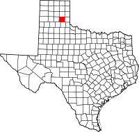
 Location in the state of Texas | |
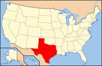
 Texas's location in the U.S. | |
| Founded | 1882 |
| Seat | Clarendon |
| Largest city | Clarendon |
| Area | |
| • Total | 933 sq mi (2,416 km2) |
| • Land | 927 sq mi (2,401 km2) |
| • Water | 6.2 sq mi (16 km2), 0.7% |
| Population (Est.) | |
| • (2015) | 3,499 |
| • Density | 4.0/sq mi (2/km²) |
| Time zone | Central: UTC-6/-5 |
| Website | www.co.donley.tx.us |
| Footnotes: For infobox source see[1] | |
Contents
County Well Data
For data sources see[2]
References
- ↑ "Donley County, Texas". Wikipedia. Retrieved 2020-12-09.
- ↑ "RRC Digital Map Data". Railrod Commission of Texas. 2020-10-15. Retrieved 2020-10-15.