Difference between revisions of "Sullivan County, New York"
m |
m |
||
| (4 intermediate revisions by the same user not shown) | |||
| Line 1: | Line 1: | ||
| − | + | {{Infobox U.S. county | |
| − | == County | + | | county = Sullivan County |
| − | == | + | | state = New York |
| + | | type = [[wikipedia:List of counties in New York|County]] | ||
| + | | coordinates = {{Coord|41.72|-74.76|display=title,inline|type:adm2nd_region:US-NY_source:UScensus1990}} | ||
| + | | flag = Flag of Sullivan County, New York.jpg | ||
| + | | seal = Sullivan County, New York seal.png | ||
| + | | founded = 1809 | ||
| + | | seat wl= Monticello | ||
| + | | largest city = Monticello | ||
| + | | city type = village | ||
| + | | area_total_sq_mi = 997 | ||
| + | | area_land_sq_mi = 968 | ||
| + | | area_water_sq_mi = 29 | ||
| + | | area percentage = 2.9 | ||
| + | | census estimate yr = 2019 | ||
| + | | pop = 75432 | ||
| + | | density_sq_mi = 78 | ||
| + | | web = co.sullivan.ny.us | ||
| + | | ex image = Shallow Stream in Rock Hill, NY.jpg | ||
| + | | ex image cap = Stream in the hamlet of [[wikipedia:Rock Hill, New York|Rock Hill]] | ||
| + | | time zone = Eastern | ||
| + | | named for = [[wikipedia:John Sullivan (general)|John Sullivan]] | ||
| + | | footnotes = For infobox source see<ref>{{cite web | ||
| + | | title = Sullivan County, New York | ||
| + | | publisher = Wikipedia | ||
| + | | url = https://en.wikipedia.org/wiki/Sullivan_County,_New_York | ||
| + | | accessdate = 2021-07-19}}</ref> | ||
| + | }}__TOC__ | ||
| + | == County Well Data == | ||
{| class="wikitable sortable" width="95%" | {| class="wikitable sortable" width="95%" | ||
!scope="col" | Well ID | !scope="col" | Well ID | ||
!scope="col" | Municipality | !scope="col" | Municipality | ||
!scope="col" | Operator Name | !scope="col" | Operator Name | ||
| − | !scope="col" | | + | !scope="col" | Permit Date |
!scope="col" | Spud Date | !scope="col" | Spud Date | ||
| − | !scope="col" | | + | !scope="col" | Configuration |
| − | !scope="col" | | + | !scope="col" | Well Status |
| − | + | |- | |
| − | + | | [[31-105-02359]] | |
| + | | | ||
| + | | [[Standard Oil Co.]] | ||
| + | | | ||
| + | | | ||
| + | | Vertical | ||
| + | | Unknown | ||
| + | |- | ||
| + | | [[31-105-08578]] | ||
| + | | [[Rockland,_Sullivan_County,_New_York|Rockland]] | ||
| + | | [[Texas Eastern Transmission Co.]] | ||
| + | | | ||
| + | | 1971-08-23 | ||
| + | | Vertical | ||
| + | | Plugged And Abandoned | ||
| + | |- | ||
| + | | [[31-105-12861]] | ||
| + | | [[Thompson,_Sullivan_County,_New_York|Thompson]] | ||
| + | | [[Gulf Oil Corp.]] | ||
| + | | 1977-09-27 | ||
| + | | 1977-09-27 | ||
| + | | Vertical | ||
| + | | Plugged And Abandoned | ||
| + | |- | ||
|} | |} | ||
| + | For data sources see<ref>{{cite web | ||
| + | | title = Public Wells Data | ||
| + | |publisher = New York State Department of Environmental Conservation | ||
| + | | date = 2019-08-09 | ||
| + | | url = http://wellwiki.org/wiki/New_York_Oil_and_Gas_Data_Sources | ||
| + | | accessdate = 2019-08-09 }}</ref> | ||
| + | ==References== | ||
| + | <references/> | ||
__NOEDITSECTION__ | __NOEDITSECTION__ | ||
Latest revision as of 09:41, 19 July 2021
| Sullivan County, New York | |||
|---|---|---|---|
|
Stream in the hamlet of Rock Hill | |||
| |||
 Location in the state of New York | |||
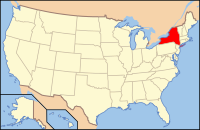
 New York's location in the U.S. | |||
| Founded | 1809 | ||
| Named for | John Sullivan | ||
| Seat | Monticello | ||
| Largest village | Monticello | ||
| Area | |||
| • Total | 997 sq mi (2,582 km2) | ||
| • Land | 968 sq mi (2,507 km2) | ||
| • Water | 29 sq mi (75 km2), 2.9 | ||
| Population (Est.) | |||
| • (2019) | 75,432 | ||
| • Density | 78/sq mi (30/km²) | ||
| Time zone | Eastern: UTC-5/-4 | ||
| Website | co.sullivan.ny.us | ||
| Footnotes: For infobox source see[1] | |||
Contents
County Well Data
| Well ID | Municipality | Operator Name | Permit Date | Spud Date | Configuration | Well Status |
|---|---|---|---|---|---|---|
| 31-105-02359 | Standard Oil Co. | Vertical | Unknown | |||
| 31-105-08578 | Rockland | Texas Eastern Transmission Co. | 1971-08-23 | Vertical | Plugged And Abandoned | |
| 31-105-12861 | Thompson | Gulf Oil Corp. | 1977-09-27 | 1977-09-27 | Vertical | Plugged And Abandoned |
For data sources see[2]
References
- ↑ "Sullivan County, New York". Wikipedia. Retrieved 2021-07-19.
- ↑ "Public Wells Data". New York State Department of Environmental Conservation. 2019-08-09. Retrieved 2019-08-09.


