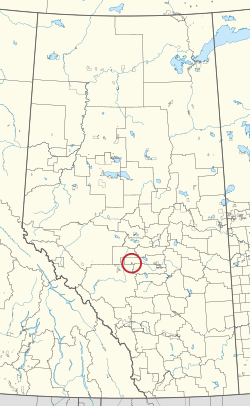
Buck Lake 133C, Alberta
| Buck Lake 133C | |
|---|---|
| Indian reserve | |
| Buck Lake Indian Reserve No. 133C | |
 | |
| First Nation | Paul |
| Treaty | 6 |
| Country | Canada |
| Province | Alberta |
| Municipal district | Wetaskiwin |
| Area | |
| • Total | 1,035.2 ha (2,558.0 acres) |
| For infobox source see[1] | |
Contents
Municipality Well Data
| UWI | Well Name | Operator Name | License Number | License Issue Date | License Status | Spud Date |
|---|---|---|---|---|---|---|
| 0455051604000 | CLEARVIEW PEMBINA 4-16-45-5 | Clearview Resources Ltd. | 0435243 | 2011-07-18 | Issued | 2011-08-19 |
| 0455051606000 | KEYERA MINHIK 6-16-45-5 | Keyera Energy Ltd. | 0209782 | 1997-12-04 | Abandoned | 1998-05-25 |
| 0455051606020 | CLEARVIEW PEMBINA 6-16-45-5 | Clearview Resources Ltd. | 0367006 | 2006-11-28 | Suspension | 2006-12-12 |
| 0455052006000 | KEYERA MINHIK 6-20-45-5 | Keyera Energy Ltd. | 0017389 | 1959-07-09 | Issued | 1959-07-19 |
| 0455052013000 | TRITON MINHIK 13-20-45-5 | Sequoia Resources Corp. | 0353120 | 2006-03-01 | Suspension | 2006-03-13 |
| 0455052013002 | TRITON MINHIK 13-20-45-5 | Sequoia Resources Corp. | 0353120 | 2006-03-01 | Suspension | 2006-03-13 |
| 0455052106000 | KEYERA MINHIK 6-21-45-5 | Keyera Energy Ltd. | 0258488 | 2001-08-14 | Issued | 2001-08-23 |
| 0455052106020 | TAC MINHIK 6-21-45-5 | Tamarack Acquisition Corp. | 0288433 | 2003-06-13 | Suspension | 2003-07-04 |
| 0455052108000 | TAC MINHIK 8-21-45-5 | Tamarack Acquisition Corp. | 0135793 | 1988-08-25 | Abandoned | 1988-09-01 |
References
- ↑ "Buck Lake 133C". Wikipedia. Retrieved 2021-01-15.
- ↑ "General Well Data File - Licensing Data". Alberta Energy Regulator. 2020-04-22. Retrieved 2020-05-07.
- ↑ "General Well Data File - Drilling Data". Alberta Energy Regulator. 2020-04-22. Retrieved 2020-05-07.