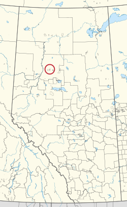
Woodland Cree 227, Alberta
| Woodland Cree 227 | |
|---|---|
| Indian reserve | |
| Woodland Cree Indian Reserve No. 227 | |
 | |
| First Nation | Woodland Cree |
| Treaty | 8 |
| Country | Canada |
| Province | Alberta |
| Municipal district | Northern Sunrise |
| Area | |
| • Total | 660 ha (1,630 acres) |
| For infobox source see[1] | |
Contents
Municipality Well Data
| UWI | Well Name | Operator Name | License Number | License Issue Date | License Status | Spud Date |
|---|---|---|---|---|---|---|
| 0875151706000 | LOCHIEL PEX GOLDEN 6-17-87-15 | Lochiel Exploration Ltd. | 0119543 | 1985-11-21 | RecCertified | 1985-11-22 |
| 0875161214000 | WESTCOAST ET AL GOLDEN 14-12-87-16 | Devon Canada Corporation | 0095293 | 1982-02-25 | RecCertified | 1982-02-28 |
| 0875161306AA0 | BAYTEX GOLDEN 6-13-87-16 | Baytex Energy Ltd. | 0493575 | 2019-01-24 | Abandoned | 2019-02-28 |
References
- ↑ "Woodland Cree 227". Wikipedia. Retrieved 2021-01-15.
- ↑ "General Well Data File - Licensing Data". Alberta Energy Regulator. 2020-04-22. Retrieved 2020-05-07.
- ↑ "General Well Data File - Drilling Data". Alberta Energy Regulator. 2020-04-22. Retrieved 2020-05-07.