Kane County, Utah
| Kane County, Utah | |
|---|---|
|
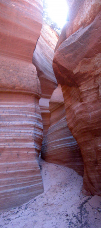
Narrows in Diana's Throne Canyon, also known as the Huntress Slot in vicinity of Mount Carmel Junction. | |
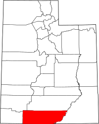
 Location in the state of Utah | |
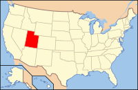
 Utah's location in the U.S. | |
| Founded | January 16, 1864 |
| Named for | Thomas L. Kane |
| Seat | Kanab |
| Largest city | Kanab |
| Area | |
| • Total | 4,109 sq mi (10,642 km2) |
| • Land | 3,990 sq mi (10,334 km2) |
| • Water | 118 sq mi (306 km2), 2.9 |
| Time zone | Mountain: UTC-7/-6 |
| Website | kane.utah.gov |
| Footnotes: For infobox source see[1] | |
Contents
County Well Data
| Well ID | Operator Name | Well Type | Well Status |
|---|---|---|---|
| 43-025-30003 | G C BINGHAM | OIL & NATURAL GAS WELL | WELL DEVELOPMENT |
| 43-025-30016 | HOUSTON OIL & MINERALS | OIL & NATURAL GAS WELL | WELL DEVELOPMENT |
| 43-025-30017 | HOUSTON OIL & MINERALS | OIL & NATURAL GAS WELL | WELL DEVELOPMENT |
| 43-025-30018 | Amoco Production Company | OIL & NATURAL GAS WELL | WELL DEVELOPMENT |
| 43-025-30019 | ROCKY MOUNTAIN EXPLOR CO | OIL & NATURAL GAS WELL | WELL DEVELOPMENT |
| 43-025-30020 | BOSWELL ENERGY CORP | OIL & NATURAL GAS WELL | WELL DEVELOPMENT |
| 43-025-30023 | BURNETT OIL CO INC | OIL & NATURAL GAS WELL | WELL DEVELOPMENT |
| 43-025-30031 | CONOCO INC | OIL & NATURAL GAS WELL | WELL DEVELOPMENT |
| 43-025-30040 | LEGEND ENERGY OF UTAH LLC | OIL & NATURAL GAS WELL | WELL DEVELOPMENT |
| 43-025-30041 | LEGEND ENERGY OF UTAH LLC | OIL & NATURAL GAS WELL | WELL DEVELOPMENT |
| 43-025-30044 | LEGEND ENERGY OF UTAH LLC | OIL & NATURAL GAS WELL | WELL DEVELOPMENT |
For data sources see[2]
References
- ↑ "Kane County, Utah". Wikipedia. Retrieved 2020-11-04.
- ↑ "Oil and Natural Gas Wells". Homeland Infrastructure Foundation-Level Data. 2019-09-24. Retrieved 2020-09-12.
