Lyndhurst, Ohio
| Lyndhurst, Ohio | |
|---|---|
| City | |
 Location in Cuyahoga County and the state of Ohio. | |
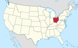
 Location of Ohio in the United States | |
| Country | United States |
| State | Ohio |
| County | Cuyahoga |
| Area | |
| • Total | 4.44 sq mi (11.49 km2) |
| • Land | 4.43 sq mi (11.48 km2) |
| • Water | 0.01 sq mi (0.01 km2) |
| Elevation | 1,033 ft (315 m) |
| Population (2010) | |
| • Estimate (2019) | 13,366 |
| ZIP code | 44124 |
| Area code(s) | 216, 440 |
| Website | http://www.lyndhurst-oh.com/ |
| For infobox source see[1] | |
Contents
Municipality Well Data
| Well ID | Operator Name | Permit Date | Spud Date | Configuration | License Status |
|---|---|---|---|---|---|
| 34-035-21392 | JONES WALTER CONSTRUCTION | 1986-09-11 | Vertical | Final Restoration | |
| 34-035-21610 | BASS ENERGY CO INC | 1996-02-01 | 1996-03-28 | Vertical | Producing |
| 34-035-21623 | BASS ENERGY CO INC | 2002-05-13 | 2002-08-21 | Vertical | Producing |
| 34-035-21624 | BASS ENERGY CO INC | 2003-10-03 | 2003-11-02 | Vertical | Producing |
| 34-035-21648 | BASS ENERGY CO INC | 1998-11-16 | 1998-01-02 | Vertical | Final Restoration |
| 34-035-21649 | BASS ENERGY CO INC | 1997-11-24 | 1998-04-25 | Vertical | Producing |
| 34-035-21670 | BASS ENERGY CO INC | 1999-02-08 | 1999-02-16 | Directional | Producing |
| 34-035-21679 | BASS ENERGY CO INC | 1999-11-03 | 1999-12-03 | Directional | Producing |
| 34-035-21706 | BASS ENERGY CO INC | 2000-12-11 | 2001-01-10 | Vertical | Producing |
| 34-035-21823 | BASS ENERGY CO INC | 2009-01-27 | Directional | Not Drilled | |
| 34-035-21824 | BASS ENERGY CO INC | 2009-01-27 | Directional | Not Drilled | |
| 34-035-21836 | BASS ENERGY CO INC | 2005-03-11 | 2005-03-12 | Vertical | Producing |
| 34-035-22162 | BASS ENERGY CO INC | 2010-04-20 | 2010-05-19 | Vertical | Producing |
| 34-035-60345 | HISTORIC OWNER | Vertical | Historical Production Well | ||
| 34-035-60346 | GONSALVES NORMAN | 2001-11-29 | Vertical | Final Restoration | |
| 34-035-60347 | HISTORIC OWNER | Vertical | Orphan Well - Ready | ||
| 34-035-60348 | HISTORIC OWNER | Vertical | Historical Production Well | ||
| 34-035-60349 | HISTORIC OWNER | Vertical | Historical Production Well | ||
| 34-035-60350 | HISTORIC OWNER | 1900-01-01 | Vertical | Historical Production Well | |
| 34-035-60355 | HISTORIC OWNER | Vertical | Not Drilled |
For data sources see[2]
References
- ↑ "Lyndhurst, Ohio#". Wikipedia. Retrieved 2021-01-11.
- ↑ "Risk Based Data Management System". Ohio Department of Natural Resources. 2020-11-16. Retrieved 2020-11-16.