Delaware Township, Hancock County, Ohio
| Deerfield Township, Morgan County, Ohio | |
|---|---|
| Township | |
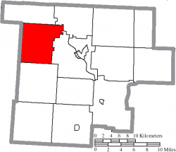
 Location of Deerfield Township in Morgan County | |
| Country | United States |
| State | Ohio |
| County | Morgan |
| Area | |
| • Total | 33.0 sq mi (85.5 km2) |
| • Land | 33.0 sq mi (85.4 km2) |
| • Water | 0.0 sq mi (0.1 km2) |
| Elevation | 1,001 ft (305 m) |
| Population (2000) | |
| • Total | 802 |
| • Density | 24.3/sq mi (9.4/km2) |
| Time zone | Eastern (EST) (UTC-5) |
| • Summer (DST) | EDT (UTC-4) |
| For infobox source see[1] | |
Contents
Municipality Well Data
| Well ID | Operator Name | Permit Date | Spud Date | Configuration | License Status |
|---|---|---|---|---|---|
| 34-063-20004 | HISTORIC OWNER | 1936-10-21 | Vertical | Historical Production Well | |
| 34-063-20016 | HISTORIC OWNER | 1938-10-01 | Vertical | Plugged and Abandoned | |
| 34-063-20017 | HISTORIC OWNER | 1940-09-09 | Vertical | Plugged and Abandoned | |
| 34-063-20021 | HISTORIC OWNER | 1945-10-01 | Vertical | Dry and Abandoned | |
| 34-063-20022 | HISTORIC OWNER | 1950-10-01 | Vertical | Plugged and Abandoned | |
| 34-063-20037 | HISTORIC OWNER | 1952-07-30 | 1900-01-01 | Vertical | Plugged and Abandoned |
| 34-063-20117 | HISTORIC OWNER | 1962-02-16 | 1962-02-15 | Vertical | Dry and Abandoned |
| 34-063-20121 | HISTORIC OWNER | 1962-09-07 | Vertical | Plugged and Abandoned | |
| 34-063-20131 | HISTORIC OWNER | 1963-06-21 | 1963-07-06 | Vertical | Plugged and Abandoned |
| 34-063-20204 | HISTORIC OWNER | 1979-09-30 | 1900-01-01 | Vertical | Plugged and Abandoned |
| 34-063-20287 | ASHLAND DRILLING CO INC | 1986-08-13 | Vertical | Final Restoration | |
| 34-063-20288 | ASHLAND DRILLING CO INC | 1986-09-05 | Vertical | Final Restoration | |
| 34-063-62193 | HISTORIC OWNER | 1900-01-01 | Vertical | Historical Production Well | |
| 34-063-62194 | HISTORIC OWNER | Vertical | Final Restoration | ||
| 34-063-62195 | HISTORIC OWNER | 1900-01-01 | Vertical | Field Inspected: Well Not Found | |
| 34-063-62196 | HISTORIC OWNER | 1900-01-01 | Vertical | Field Inspected: Well Not Found | |
| 34-063-62197 | HISTORIC OWNER | 1900-01-01 | Vertical | Field Inspected: Well Not Found | |
| 34-063-62198 | HISTORIC OWNER | 1900-01-01 | Vertical | Field Inspected: Well Not Found | |
| 34-063-62199 | HISTORIC OWNER | 1900-01-01 | Vertical | Historical Production Well | |
| 34-063-62200 | HISTORIC OWNER | 1900-01-01 | Vertical | Historical Production Well | |
| 34-063-62201 | HISTORIC OWNER | 1900-01-01 | Vertical | Historical Production Well | |
| 34-063-62202 | HISTORIC OWNER | 1900-01-01 | Vertical | Historical Production Well | |
| 34-063-62203 | HISTORIC OWNER | Vertical | Not Drilled | ||
| 34-063-62205 | HISTORIC OWNER | Vertical | Not Drilled | ||
| 34-063-62206 | HISTORIC OWNER | Vertical | Not Drilled | ||
| 34-063-62207 | HISTORIC OWNER | 1900-01-01 | Vertical | Field Inspected: Well Not Found | |
| 34-063-62208 | HISTORIC OWNER | Vertical | Plugged and Abandoned | ||
| 34-063-62209 | HISTORIC OWNER | 1900-01-01 | Vertical | Field Inspected: Well Not Found | |
| 34-063-62210 | HISTORIC OWNER | 1900-01-01 | Vertical | Field Inspected: Well Not Found | |
| 34-063-62211 | HISTORIC OWNER | Vertical | Not Drilled | ||
| 34-063-62212 | HISTORIC OWNER | 1900-01-01 | Vertical | Field Inspected: Well Not Found | |
| 34-063-67192 | HISTORIC OWNER | 1900-01-01 | Vertical | Historical Production Well | |
| 34-063-67193 | HISTORIC OWNER | 1900-01-01 | Vertical | Historical Production Well | |
| 34-063-67194 | HISTORIC OWNER | 1900-01-01 | Vertical | Historical Production Well | |
| 34-063-67195 | HISTORIC OWNER | 1900-01-01 | Vertical | Unknown status | |
| 34-063-67196 | HISTORIC OWNER | 1900-01-01 | Vertical | Historical Production Well | |
| 34-063-67197 | HISTORIC OWNER | 1900-01-01 | Vertical | Historical Production Well | |
| 34-063-67304 | HISTORIC OWNER | 1900-01-01 | Vertical | Historical Production Well |
For data sources see[2]
References
- ↑ "Deerfield Township, Morgan County, Ohio#". Wikipedia. Retrieved 2021-01-11.
- ↑ "Risk Based Data Management System". Ohio Department of Natural Resources. 2020-11-16. Retrieved 2020-11-16.