Navajo County, Arizona
| Navajo County, Arizona | ||
|---|---|---|
|
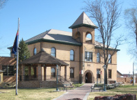
Historic Navajo County Courthouse and Museum in Holbrook | ||
| ||
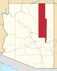
 Location in the state of Arizona | ||
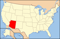
 Arizona's location in the U.S. | ||
| Founded | March 21, 1895 | |
| Named for | Navajo Nation | |
| Seat | Holbrook | |
| Largest city | Show Low | |
| Area | ||
| • Total | 9,960 sq mi (25,796 km2) | |
| • Land | 9,950 sq mi (25,770 km2) | |
| • Water | 9.3 sq mi (24 km2), 0.09% | |
| Time zone | Mountain: UTC-7 | |
| Website | www.navajocountyaz.gov | |
| Footnotes: For infobox source see[1] | ||
Contents
[hide]County Well Data
| Well ID | Operator Name | Well Type | Well Status |
|---|---|---|---|
| 02-017-20063 | SOUTHWEST/PASSPORT | OIL & NATURAL GAS WELL | PRODUCING, NON-ACTIVE WELL |
| 02-017-20067 | TRIOMPHE ENERGY | OIL & NATURAL GAS WELL | PRODUCING, NON-ACTIVE WELL |
| 02-017-20072 | SOUTHWEST/PASSPORT | OIL & NATURAL GAS WELL | PRODUCING, NON-ACTIVE WELL |
| 02-017-20113 | BLACKSTONE EXPLORATION | OIL & NATURAL GAS WELL | UNKNOWN WELL |
| 02-017-20114 | BLACKSTONE EXPLORATION | OIL & NATURAL GAS WELL | UNKNOWN WELL |
| 02-017-20115 | BLACKSTONE EXPLORATION | OIL & NATURAL GAS WELL | UNKNOWN WELL |
| 02-017-20116 | BLACKSTONE EXPLORATION | OIL & NATURAL GAS WELL | UNKNOWN WELL |
| 02-017-20117 | BLACKSTONE EXPLORATION | OIL & NATURAL GAS WELL | UNKNOWN WELL |
For data sources see[2]
References
- Jump up ↑ "Navajo County, Arizona". Wikipedia. Retrieved 2020-11-04.
- Jump up ↑ "Oil and Natural Gas Wells". Homeland Infrastructure Foundation-Level Data. 2019-09-24. Retrieved 2020-09-12.

