X

Track changes made to this page

If you find this page useful and would like to be notified of changes made to this page, start by inputting your email below.


Privacy policy
Close this window

powered by ChangeDetection

Oliver County, North Dakota

Oliver County, North Dakota
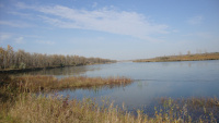
Cross Ranch State Park, North Dakota (5069906194).jpg
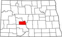
Map of North Dakota highlighting Oliver County
Location in the state of North Dakota
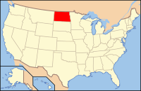
Map of the United States highlighting North Dakota
North Dakota's location in the U.S.
Founded April 14, 1885 (created)
May 18, 1885 (organized)
Named for Harry S. Oliver
Seat Center
Largest city Center
Area
 • Total 731 sq mi (1,893 km2)
 • Land 723 sq mi (1,873 km2)
 • Water 8.7 sq mi (23 km2), 1.2
Time zone Central: UTC-6/-5
Footnotes: For infobox source see[1]

County Well Data

Well ID Operator Name Well Type Well Status
33-065-00001 Farmers Union Central Exchange, Inc. Dry Hole Dry
33-065-00002 Youngblood & Youngblood Dry Hole Dry
33-065-00003 Signal Drilling & Exploration, Inc. Dry Hole Dry
33-065-00004 SUNRAY DX OIL CO. Dry Hole Dry
33-065-00005 General American Oil Company Of Texas Dry Hole Dry
33-065-00006 General American Oil Company Of Texas Dry Hole Dry
33-065-00007 General American Oil Company Of Texas Dry Hole Dry
33-065-00008 General American Oil Company Of Texas Dry Hole Dry
33-065-00009 General American Oil Company Of Texas Dry Hole Dry
33-065-00010 General American Oil Company Of Texas Dry Hole Dry
33-065-00011 W. H. Hunt Trust Estate Dry Hole Dry
33-065-00012 Calvert Drilling & R. K. Petroleum Corp. Dry Hole Dry
33-065-00013 Cardinal Petroleum Co. & R. K. Petroleum Dry Hole Dry
33-065-00014 Pennzoil Co. Dry Hole Dry
33-065-00015 Pennzoil Co. Never Drilled Permit Cancelled
33-065-00016 Exxon Company, U.S.A. Dry Hole Dry
33-065-00017 Aceite Energy Corp. Dry Hole Dry

For data sources see[2]

References

  1. "Oliver County, North Dakota". Wikipedia. Retrieved 2020-11-04. 
  2. "Petroleum related wells". U.S. Geological Survey. 2014-08-06. Retrieved 2020-09-12.