Lancaster, Ohio
| Lancaster, Ohio | |
|---|---|
| City | |
| City of Lancaster | |
| Nickname(s): "Glass City", "The Stir", "L Town", "Little Vegas" | |
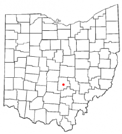
 Location of Lancaster, Ohio | |
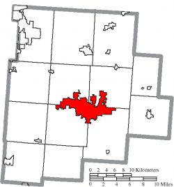
 Location of Lancaster in Fairfield County | |
| Country | United States |
| State | Ohio |
| County | Fairfield |
| Area | |
| • Total | 18.92 sq mi (48.99 km2) |
| • Land | 18.85 sq mi (48.83 km2) |
| • Water | 0.06 sq mi (0.17 km2) |
| Elevation | 879 ft (268 m) |
| Population (2010) | |
| • Total | 38,780 |
| • Estimate (2019) | 40,505 |
| • Density | 2,148.58/sq mi (829.59/km2) |
| Demonym | Lancastrian |
| Time zone | EST (UTC−5) |
| • Summer (DST) | EDT (UTC−4) |
| ZIP code | 43130 |
| Area code | 740 and 220 |
| Website | www.ci.lancaster.oh.us |
| For infobox source see[1] | |
Contents
Municipality Well Data
| Well ID | Operator Name | Permit Date | Spud Date | Configuration | License Status |
|---|---|---|---|---|---|
| 34-045-20062 | HISTORIC OWNER | 1937-06-23 | Vertical | Historical Production Well | |
| 34-045-20070 | HISTORIC OWNER | Vertical | Not Drilled | ||
| 34-045-20078 | HISTORIC OWNER | Vertical | Not Drilled | ||
| 34-045-20090 | HISTORIC OWNER | Vertical | Not Drilled | ||
| 34-045-20134 | HISTORIC OWNER | 1940-11-05 | Vertical | Historical Production Well | |
| 34-045-20157 | HISTORIC OWNER | 1944-06-12 | Vertical | Field Inspected: Well Not Found | |
| 34-045-20158 | HISTORIC OWNER | 1944-09-07 | Vertical | Plugged and Abandoned | |
| 34-045-20184 | COLUMBIA GAS TRANSMISSION LLC | 1988-08-19 | 1950-04-03 | Vertical | Final Restoration |
| 34-045-20449 | HISTORIC OWNER | 1966-09-08 | 1939-12-01 | Vertical | Plugged and Abandoned |
| 34-045-20514 | LOVERIDGE JOHN | 1990-10-01 | 1973-12-01 | Vertical | Final Restoration |
| 34-045-20558 | HISTORIC OWNER | 1975-12-15 | Vertical | Not Drilled | |
| 34-045-20750 | ALTIER PETROLEUM INC | 1981-10-05 | Vertical | Not Drilled | |
| 34-045-20751 | ALTIER PETROLEUM INC | 1981-10-05 | Vertical | Not Drilled | |
| 34-045-21088 | BELDEN & BLAKE CORPORATION | 1991-05-17 | Vertical | Not Drilled | |
| 34-045-60001 | HISTORIC OWNER | 1900-01-01 | Vertical | Historical Production Well | |
| 34-045-60003 | HISTORIC OWNER | 1900-01-01 | Vertical | Historical Production Well | |
| 34-045-60004 | HISTORIC OWNER | 1900-01-01 | Vertical | Historical Production Well | |
| 34-045-60005 | HISTORIC OWNER | 1900-01-01 | Vertical | Plugged and Abandoned | |
| 34-045-60006 | HISTORIC OWNER | 1900-01-01 | Vertical | Historical Production Well | |
| 34-045-60007 | HISTORIC OWNER | 1900-01-01 | Vertical | Historical Production Well | |
| 34-045-60008 | HISTORIC OWNER | 1900-01-01 | Vertical | Historical Production Well | |
| 34-045-60054 | HISTORIC OWNER | 1900-01-01 | Vertical | Historical Production Well | |
| 34-045-60055 | HISTORIC OWNER | 1900-01-01 | Vertical | Historical Production Well | |
| 34-045-60059 | HISTORIC OWNER | 1900-01-01 | Vertical | Historical Production Well | |
| 34-045-60263 | HISTORIC OWNER | Vertical | Plugged and Abandoned | ||
| 34-045-60307 | HISTORIC OWNER | 1900-01-01 | Vertical | Plugged and Abandoned | |
| 34-045-60308 | HISTORIC OWNER | 1900-01-01 | Vertical | Plugged and Abandoned | |
| 34-045-60310 | HISTORIC OWNER | 1900-01-01 | Vertical | Plugged and Abandoned | |
| 34-045-60311 | HISTORIC OWNER | 1900-01-01 | Vertical | Plugged and Abandoned | |
| 34-045-60345 | HISTORIC OWNER | 1900-01-01 | Vertical | Plugged and Abandoned | |
| 34-045-60346 | HISTORIC OWNER | 1900-01-01 | Vertical | Historical Production Well | |
| 34-045-60556 | HISTORIC OWNER | 1900-01-01 | Vertical | Plugged and Abandoned | |
| 34-045-60557 | HISTORIC OWNER | Vertical | Plugged and Abandoned | ||
| 34-045-60559 | HISTORIC OWNER | 1900-01-01 | Vertical | Historical Production Well | |
| 34-045-60560 | HISTORIC OWNER | 1900-01-01 | Vertical | Historical Production Well | |
| 34-045-60561 | HISTORIC OWNER | 1900-01-01 | Vertical | Historical Production Well | |
| 34-045-60566 | HISTORIC OWNER | 1905-09-16 | Vertical | Historical Production Well | |
| 34-045-60571 | HISTORIC OWNER | 1900-01-01 | Vertical | Historical Production Well | |
| 34-045-60594 | HISTORIC OWNER | 1900-01-01 | Vertical | Historical Production Well | |
| 34-045-60595 | HISTORIC OWNER | 1900-01-01 | Vertical | Historical Production Well | |
| 34-045-60598 | HISTORIC OWNER | 1900-01-01 | Vertical | Plugged and Abandoned | |
| 34-045-60601 | NOLAND NOLAND & STRAWN | 1985-07-09 | 1900-01-01 | Vertical | Orphan Well - Ready |
| 34-045-60602 | HISTORIC OWNER | 1900-01-01 | Vertical | Historical Production Well | |
| 34-045-60604 | HISTORIC OWNER | 1900-01-01 | Vertical | Historical Production Well | |
| 34-045-60607 | HISTORIC OWNER | 1900-01-01 | Vertical | Historical Production Well | |
| 34-045-60608 | HISTORIC OWNER | 1900-01-01 | Vertical | Historical Production Well | |
| 34-045-60609 | HISTORIC OWNER | 1900-01-01 | Vertical | Historical Production Well | |
| 34-045-60669 | HISTORIC OWNER | 1900-01-01 | Vertical | Plugged and Abandoned | |
| 34-045-60675 | HISTORIC OWNER | 1900-01-01 | Vertical | Historical Production Well | |
| 34-045-60676 | HISTORIC OWNER | 1900-01-01 | Vertical | Plugged and Abandoned | |
| 34-045-60678 | HISTORIC OWNER | Vertical | Historical Production Well | ||
| 34-045-60679 | HISTORIC OWNER | 1900-01-01 | Vertical | Plugged and Abandoned | |
| 34-045-60680 | HISTORIC OWNER | 1900-01-01 | Vertical | Historical Production Well | |
| 34-045-60682 | HISTORIC OWNER | 1900-01-01 | Vertical | Historical Production Well | |
| 34-045-60683 | HISTORIC OWNER | 1900-01-01 | Vertical | Historical Production Well | |
| 34-045-60684 | HISTORIC OWNER | 1900-01-01 | Vertical | Historical Production Well | |
| 34-045-61705 | HISTORIC OWNER | 1900-01-01 | Vertical | Orphan Well - Ready |
For data sources see[2]
References
- ↑ "Lancaster, Ohio#". Wikipedia. Retrieved 2021-01-11.
- ↑ "Risk Based Data Management System". Ohio Department of Natural Resources. 2020-11-16. Retrieved 2020-11-16.